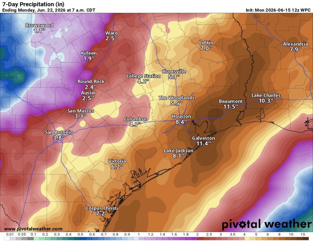
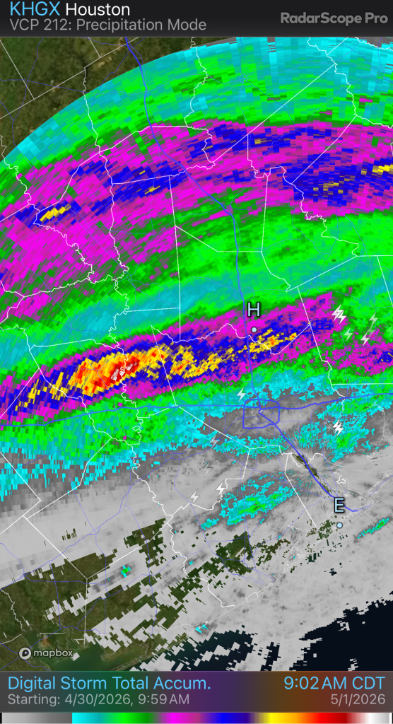
We’ve had a wet start to summer and this will continue this week. A front will combine with a tropical disturbance over SE Texas this week bringing us very heavy rains. Flooding will be possible, especially near the coast. Never drive into flooded roadways.
Lots of rain is coming for the Houston area. No need to go into the technical details. It’s about to rain. A lot. Be prepared and don’t drive into flooded roadways.
The last several days have featured a lot of severe weather across North Texas (and states to the north and east).
All the warm air across Southeast Texas has been fueling these storms up north.
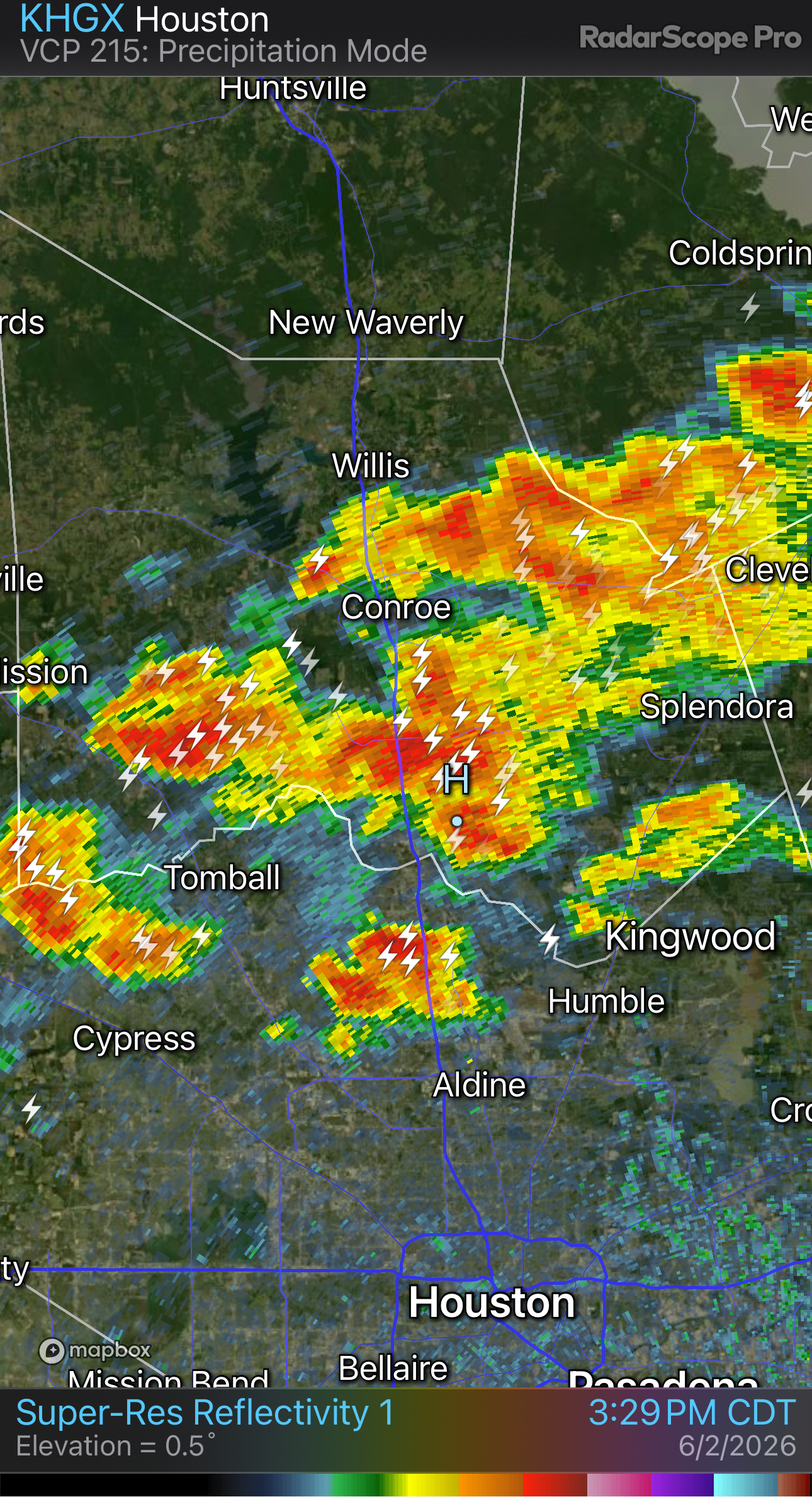
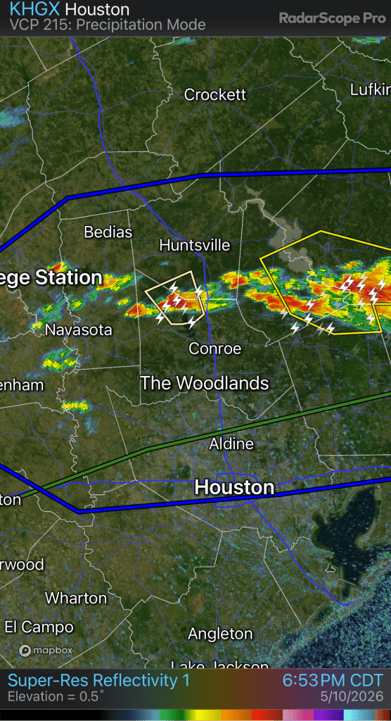
Starting today, things will shift south and begin to impact Southeast Texas. A cold front will approach the area this afternoon and stall near the I-10 corridor. We should see thunderstorms develop along and ahead of the front this afternoon once daytime heating can overcome the cap.
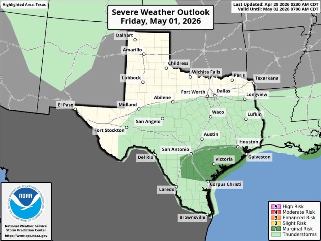
The front will stall and drift north before a stronger cold front heads this way on Friday.
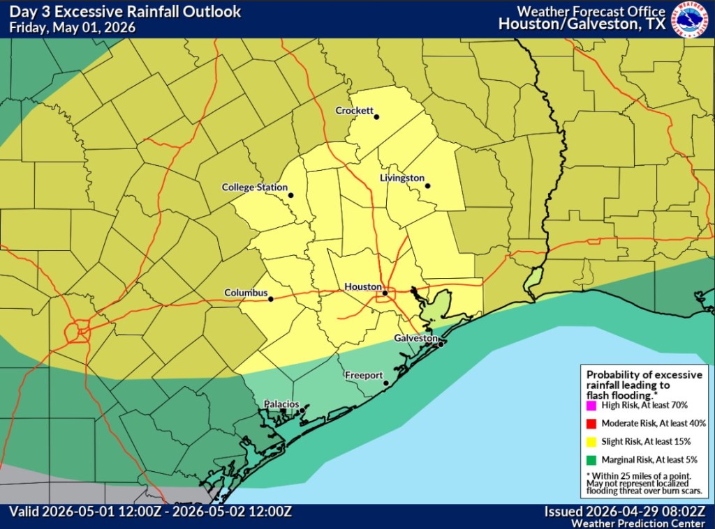
Friday will feature an even better shot of widespread showers and thunderstorms across the area and an enhanced chance of localized flooding.
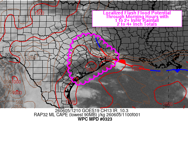
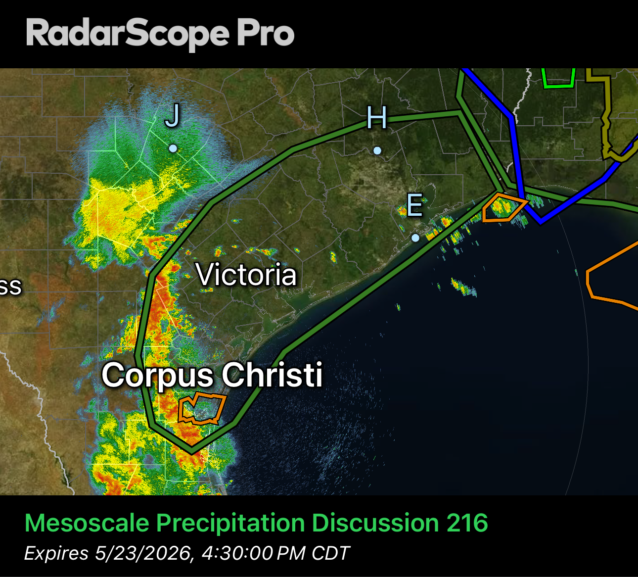
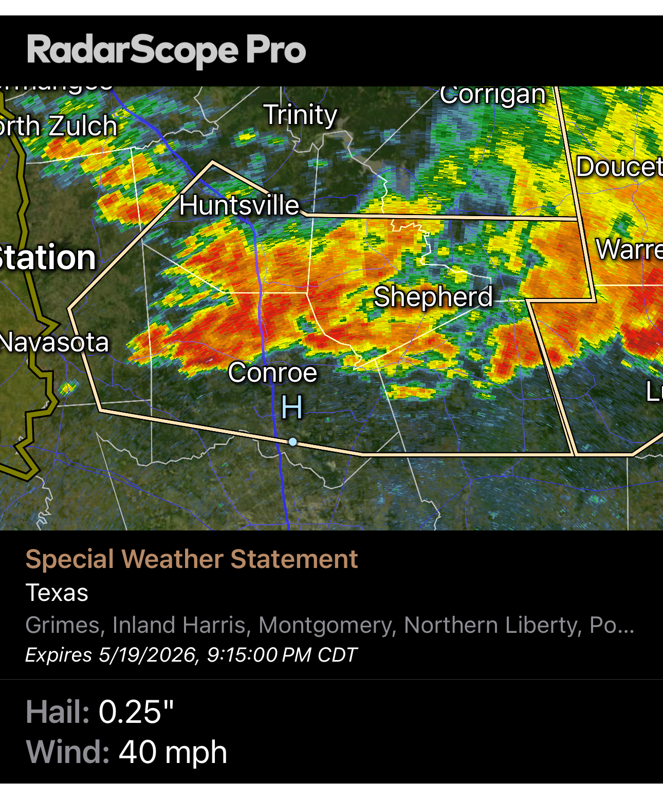
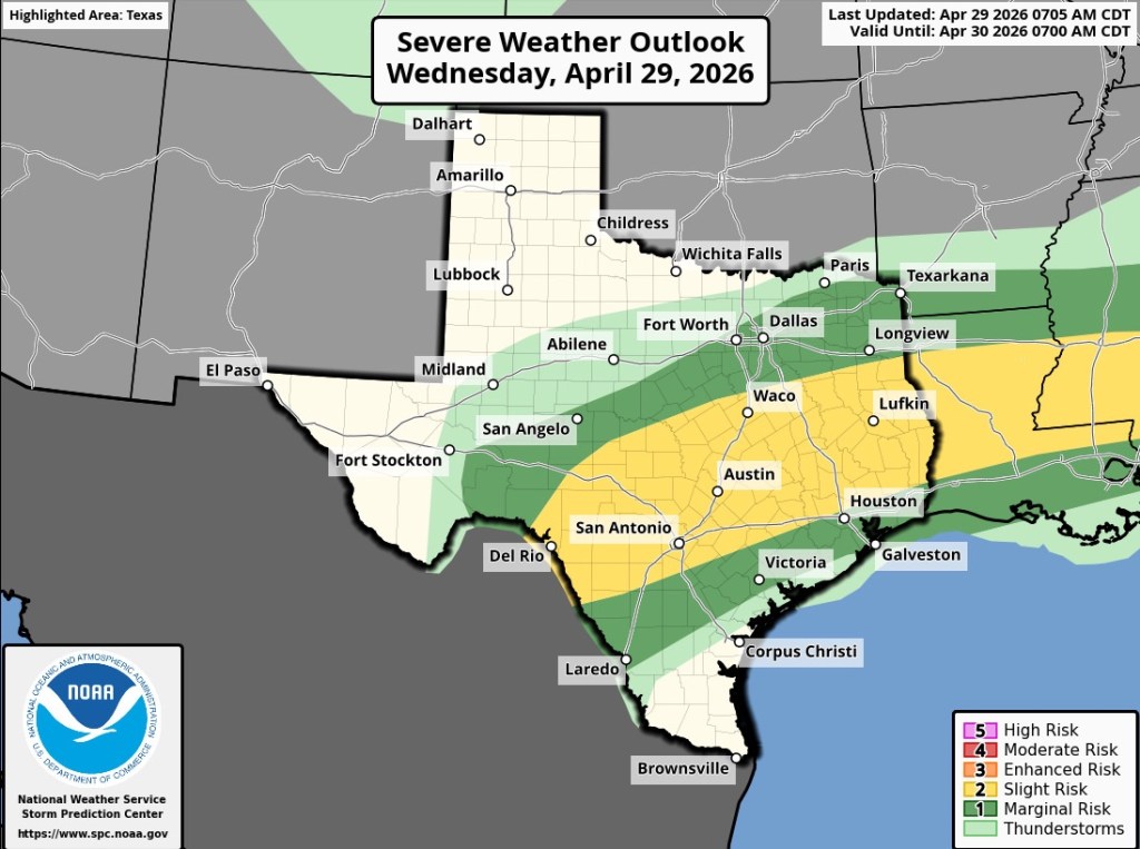
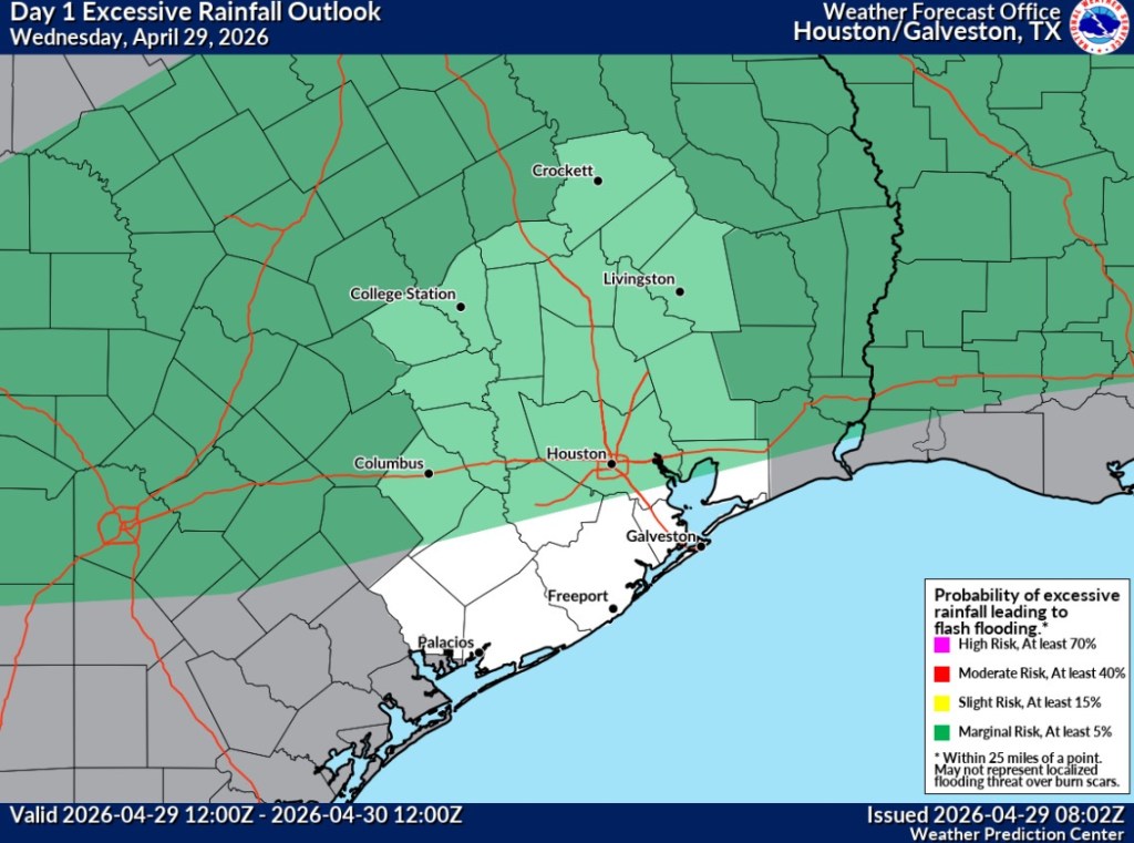
The storms today and Friday will both bring a chance of severe weather, heavy downpours, and isolated flooding wherever storms begin to train over the same area. The Storm Prediction Center and the Weather Presenter Center have placed the area under a risk for severe weather and flooding. Today and Friday are days to keep a watch out for any severe weather watches or warnings.
After Friday’s front, this weekend will bring yet another reminder that summer isn’t here quite yet. We will have a refreshing shot of lows in the 50’s and highs in the 70’s for a few days.
Enjoy it while it lasts, as next week will see temperatures climbing again. Probably to stay.
Today’s Severe Weather Outlook Today’s Flooding ThreatFriday’s Severe Weather ThreatFriday’s Excessive Rainfall Threat