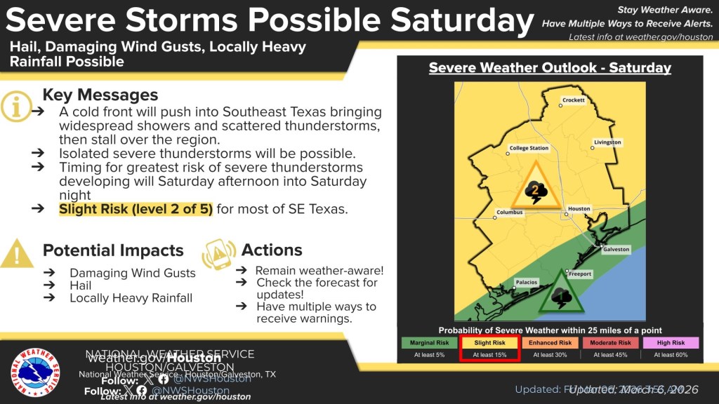
Stormy weather will arrive in Southeast Texas this weekend. Some questions remain around timing but the picture is coming into focus now.
We are now within range of most of the high-resolution models. These models show the storms moving into the Houston Metro area later in the day (versus midday). I think this is the right trend and most of us will stay dry most of Saturday. So, not a washout tomorrow. By late afternoon, a squall line will form and move through during the evening hours. Some of the storms could be severe, especially as the first storms pop-up. Any isolated cells could become tornadic. As the storms mature into a squall line, the main threat will transition into straight-line winds.
Keep a close eye on the weather tomorrow and plan to be ‘stuck’ wherever you are sometime in the evening.
Jason Schlitz